
Blog

Dangerous Dargan and an Old Indian Deed
Sponsored by Xponential With apologies to both the residents of southern Washington County, Maryland, and to the Native Americans; this title reflects an old, somewhat derogatory term for an area, and the title of a sign placed by the Maryland State Roads Commission in that same area. As I was driving along Harper’s Ferry Road...

Three Critical Skills of a Land Surveyor Expert Witness
By Tony Nettleman (Part Two) Serving as an expert witness and testifying in court is enjoyable, fulfilling, and a great supplemental offering within your land surveying practice. While providing these services for the previous 20-plus years, I discovered three critical skills that will aid the surveyor in being the best expert witness they can be. ...

Rapidly Mapping Infrastructure
Could a Pittsburgh-based start-up help improve (and save) America’s bridges? Early in the morning of January 28, 2022, a Pittsburgh Regional Transit Authority bus crossing the Fern Hollow Bridge began bouncing and shaking for no apparent reason. Moments later it plummeted into a ravine along with several other vehicles as the bridge collapsed beneath them....

xyHt Weekly News Recap: 04/14/2023
INTERGEO 2023 – BIM in Construction NV5 Completes the Acquisition of L3Harris Subscription-Based Geospatial Software Business Hexagon Releases First Autonomous Construction Tech Outlook Qualcomm and Xiaomi Demonstrate Mobile Meter-Level Positioning Capabilities Worldwide UP42 and Vexcel Expand Aerial Imagery and Geospatial Data Portfolio AEM Hall of Fame Invites Nominations for 2023 Class Fugro Supports Development of...
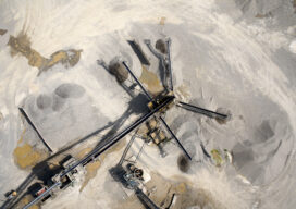
Add a Drone to Survey Fieldwork
Innovative drones offer a fast, accurate option for large-area survey data collection Since the first use of drones for commercial purposes in 2006, the drone industry has rapidly gained momentum and introduced new capabilities to serve a wide range of applications. Surveying and mapping projects pose unique challenges due to the importance of accuracy and...

Teaching the Ethics of Geo
Maps have always been powerful means of communication, whether etched in cave walls, stone, wood, silver of centuries past, or, in the 20th Century, copper plates and, later, film. In our own century, maps are everywhere—on our phones, computers, fitness apps, and news media, communicating in a myriad of ways about changes over space and...
Advertisement