
Blog

Water from the cloud
Water utility companies are tapping into geospatial cloud computing to map their infrastructure, streamline workflows, and enhance customer services
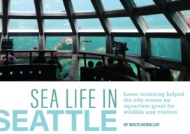
Sea Life in Seattle
Laser scanning helped the city create an aquarium great for wildlife and visitors Seattle, Washington, renowned for its vibrant cultural scene and breathtaking natural landscapes, is set to welcome a groundbreaking addition to its skyline: the Seattle Aquarium. Spearheaded by Turner Construction, recognized for its expertise in large-scale projects, this endeavor promises to redefine the...
MAPPS, NOAA, and the federal Agency Liaison Program
This is the second in a series of four articles that highlights the MAPPS Federal Agency Liaison Program with federal agency partners and specifically with the National Oceanic and Atmospheric Administration (NOAA) where MAPPS member firms have a strong interest in programs, contracts, and ongoing collaboration. By developing and continuing impactful relationships with federal agencies...

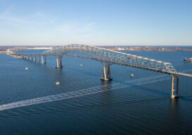
Rebuilding in Baltimore
Surveyors and geospatial professionals will play a key role in rebuilding Baltimore’s Francis Scott Key Bridge
Looking Forward: Dealing with Water
Tragedy, in the form of natural disasters, typically involves the geospatial professions. As an industry we help plan for and react to floods, wildfires, hurricanes, tornadoes and other forms of Mother Nature’s will that wreak havoc on life in a particular place. Although often in a different role, we are called upon when manmade disasters...
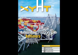
xyHt Digital Magazine: June 2024
xyHt magazine’s June 2024 issue focuses on hydrography in the geospatial world. As the oceans become increasingly important and the “blue economy” grows, the topic is becoming more important to understand. As always, if you don’t have a subscription to our print edition, or if someone else in the office has snaffled your copy, don’t...
Advertisement