
Blog
Add 3D Tiles to Cesium 1.36 to Make 3D Virtual Scenes
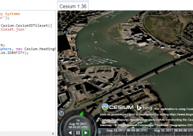
As blogs come, this has to be (for me) one of the longest. You see, I’ve been playing with Cesiumjs since its beginning and following the exciting beginnings of the “3D Tile” for the last 3 years. I’ve waited patiently, waiting for the moment I could share with the world how fantastic this new technology...

xyHt Weekly News Links: 8/18/17
PufferSphere Makes the World Go Round with Spherical Displays Joint venture to bring high-precision positioning to mass market Nearmap delivers new 3-D content and oblique imagery Hexagon Imagery Program announces updates to 2017 airborne imagery collection plans INTERGEO: where the future is within your grasp!

Certifications or Licensing? Part 2
Part 2 of 6: Legal issues affecting state licensing Editor’s Note: What will regulation, certification, and licensing of the surveying profession look like in the near and distant future? Surveying is and always has been molded by external influences: markets, technologies, economic conditions, demographics, and competition from outside of the profession. Other professionals, consumers, and...

Women in Surveying: An Accidental Surveyor Schools the Field
An unconventional geospatial technician oversees pre-construction and construction work for rehabbing a flood-control dam in VA. Pictured above: Evans inspects a recent concrete pour on the dam’s riser tower. “I’ve been on dozens of job sites and a lot of construction projects, and I have rarely worked with another female on site,” says Evans, a civil...

Controlling the Future with Training
To support user training, one company surpasses the usual by extending and supporting information, content, and new skills. Pictured above: Field training can sometimes be the most efficient way of capturing the attention of busy contractors. The surveying and construction industries are dynamic. The way people work today is clearly much different than 50 years ago,...

Drones & Surveying Flood Zones
In Juniper Flats, CA, county land surveyors use UAS to save tax dollars and project times and to improve public safety. Photo above: Steven Lewis, Trish Ortega, Paul Clements, Claudio Padres of RCFC & WCD; Sebastien Borghini of Microdrones; Dan McMahon of Allen Instruments. Joshua Tremba does a lot of mapping; he’s the supervising land surveyor...
Advertisement