
Blog

Weekly xyHt News Links: 11/30/2018
Topcon Introduces ‘Infrastructure and Technology’ Documentary Series Septentrio boosts its portfolio with mosaic GNSS module Federal Geographic Data as a Strategic Resource Topcon introduces ‘Infrastructure and Technology’ documentary series LiDARUSA Announces Z+F Mobile Systems Leica Geosystems offers new Utility Surveyor Course GeoSLAM Adds Indoor and Outdoor Handheld Scanner to Product Range Bentley Acquires Machine...

Gift Ideas for Geospatial Pros: Nifty, Thrifty, and under $50
Once again we offer up some gift-giving ideas for the geospatial professional in your family or circle of friends, or just to treat yourself—you deserve it, right? The links for each item below all go to Amazon, but choose your own vendor. Prices are accurate at the time of writing. Also, check out the Located...
Weekly xyHt News Links: 11/23/2018
vHive Releases Autonomous Drone Solution for Complex Cell Tower Inspection Avineon Completes Acquisition of InfoGeographics, Inc. Sonardyne leads ocean autonomous systems collaboration project AMW Solutions Announces Availability of PIPE and DITCH Machine Control Products
Weekly xyHt News Links: 11/16/2018
CHC Navigation introduces the Alpha3D Mobile Mapping Solution Topcon speakers to hold construction validation classes at Autodesk University Fugro Delivers Actionable Intelligence to Construction Projects with New Gaia Insight Platform KIST: Enhancing Flight Duration Time of Drones with Lithium Metal Ion Batteries Multi-objective optimisation reaching new heights with latest scheduling software release LandMentor Empowers Users for...
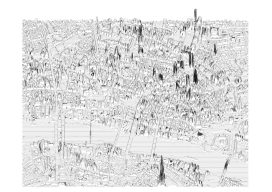
Creating Album Covers with GIS—or Drawing Elevation as Vector Lines
In July 2014, a developer and neocartographer from Scotland created the “Joy Divionesque 3D Map.” This began a four-year onslaught of maps that replicate the style of the iconic Joy Division album cover, “Unknown Pleasures.” How does it work? Essentially the elevation is taken from an underlying terrain or digital surface map as points, which...

Anti-Anti-Drone Technology
Why we need it and what form it might take. I was walking down the UAS-tech-laden hall of the 2018 Commercial UAV Expo when I spied two booths touting anti-drone technology. I thought to myself, “My issue is the opposite—keeping my UAS in the air. I don’t need any help crashing it.” Yet, looking back,...
Advertisement