
Blog

Weekly xyHt News Links: 1/4/2019
CES 2019 Innovation Award Honoree ROBOSENSE Launches New Mems Solid-State Lidar at CES 2019 Pensacola Firm Jehle-Halstead, Inc. is Acquired by National Firm McKim & Creed

Coaching Robots
Continuous surveying (to support smart cities, infrastructure, geodesign, and construction) is opening expanded—but unconventional—roles for surveyors and geospatial practitioners. Photo above (added Nov 19th, 2019): A concept partnering Hilti, Trimble and Boston Dynamics on a walking platform, here shown with an X7 scanner (press release: prn.to/33XYbcJ). A member of your field crew that’s a bipedal, survey-rod-carrying...

State Plane Coordinates 2022
Ready or not, here they come. Considering all of the outreach that the National Geodetic Survey (NGS) has been doing for the last couple of years, hopefully most of you are well aware of the National Spatial Reference System (NSRS) Modernization Project. That project will result in the replacement of both the North American Datum...

The Shutdown and Geodetic Services
Editor’s Note: We find ourselves in another government shutdown that has affected services from the National Geodetic Survey (NGS)—like the automated online post-processing user system (OPUS) that surveyors have become increasingly reliant on. Several readers asked us to re-post the following from the retired NGS chief geodetic surveyor Dave Doyle, as relevant as it was...

xyHt Magazine January 2019 Issue
Click on the cover below to view the January 2019 issue of xyHt magazine. Articles in the issue include (links will turn live throughout January): GPR on a Drone – An international research team used new UAV and GPR technology to locate a lost U.S. airplane 300 feet below the ice in Greenland. PS Exam Changes –...
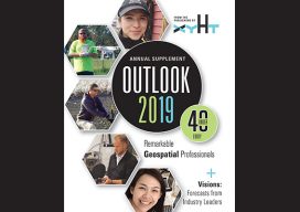
xyHt Magazine Outlook 2019 Issue
Click on the cover below to view the Outlook 2019 issue of xyHt magazine. Articles in the issue include (links will turn live throughout January and February): Coaching Robots – Continuous surveying (to support smart cities, infrastructure, geodesign, and construction) is opening expanded—but unconventional—roles for surveyors and geospatial practitioners. Gabriela Olekszyk – Surveyor & GIS Analyst, Woods Auckland,...
Advertisement