
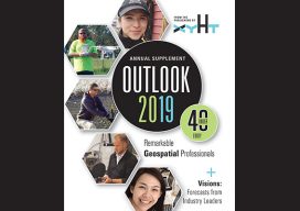
Blog
Rebecca Aguilar
Support Specialist, Topcon Positioning Systems California, USA Even the savviest users of the increasingly powerful geomatics/geospatial hardware and software sometimes need a helping hand. With great power can come great conundrums that, without excellent support resources, can be difficult to solve—especially with deadlines and spiraling costs on the line. Rebecca Aguilar has already proven to...
Justin Barton
Product Manager, Laser Scanning Systems, Leica Geosystems California, USA An early adopter and long-time practitioner of laser scanning, Justin Barton comes from an archeology background and spent nearly a decade with the world-renowned team of CyArk, a non-profit that creates digital records of sites and works of historic significance. Barton studied anthropology at UC Berkeley,...
Bronwyn Denton
Project Manager, AllTerra Land Surveying Ltd Kelowna, British Columbia, Canada While it is estimated that fewer than 10% of surveyors in British Columbia, Canada, are women, the numbers are rising, as is interest in the profession from young career seekers. This increase is reflected in more surveying lead and management positions for women in the...
Jacky C.K. Chow
President, Vusion Technologies Calgary, Canada Jacky Chow is a passionate and talented researcher in the fields of sensor fusion, robotics, machine learning, calibration, biomedical imaging, and numerical optimization. His work covers a broad scope of applications, from calibrating omnidirectional cameras for robot vision to using photogrammetric techniques for monitoring of burns patients. Although he has...
Nattaporn Thoonsaengngam
Research Assistant & Geodesist, National Astronomical Research Institute of Thailand Chiang Mai Province, Thailand “I wonder, because it is a wonder,” says Nattaporn Thoonsaengngam, a talented researcher, published geodesist, and professional photographer. The worlds of astronomy, geodesy, radio astronomy, humanity, and natural and built environments are all captured by her mind’s eye, photographer’s lens, and...

Weekly xyHt News Links: 01/25/2019
LiDAR and drones: learning to use the powerful combo Virtual Surveyor 6.2 Now Processes Larger Drone Survey Projects Exact Metrology Preserves History with Scanned Replica of Statue Topcon announces upgrade to MAGNET Collage Web complete with new deliverable options International LiDAR Mapping Forum January 28 – 30, 2019 Topcon announces advanced concrete application workflows Unique...
Advertisement