
Blog

The Evolution of Using Lidar
Above: Gary Rust (left) and Anthony Whitlock from Springs Utilities pose with their LiDAR USA HiWay Mapper HD. The history of a Colorado utility systematically deploying lidar technology reveals lidar’s journey as an asset. Located at the base of Pikes Peak on the front range of the Colorado Rockies, Colorado Springs Utilities is a city-owned...
Weekly xyHt News Links: 05/03/2019
Wing Aviation Becomes the First Unmanned Airline in the USA senseFly introduces the Solar 360 thermal drone solution for uniquely efficient solar farm inspections at AUVSI XPONENTIAL 2019 Cepton Unveils High Scan Rate, Long-Range SORA-P60L LiDAR for UAVs Tallysman Introduces the First Three Helical Products in a New Family of Lightweight Helical GNSS and Iridium...

Build, Buy, Rent, or Hire?
Seven years ago I was invited to attend a UAS flight course; this was an exciting proposition as the drone craze was not yet under way. In fact, the rules for operating drones in the U.S. were so in flux (as far as commercial and private drone use) that the course had to be held...

2019 Geospatial Summit
You Can’t Beat the Price of Admission As the march towards the new reference frame and datum rolls on approaching 2022, the National Geodetic Survey (NGS) continues to ramp up its outreach efforts to get us users prepared with the 2019 Geospatial Summit. They have hosted prior geospatial summits in 2010, 2015, and 2017, all...
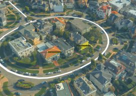
Embrace the Mesh
Above: A full 3D textured model of San Francisco produced through Skyline’s PhotoMesh 3D Reconstruction software and streamed for visualization and analytics in Skyline’s TerraExplorer. Surveyors and photogrammetrists capture reality data. But to model, manage, and provide access to massive and complex datasets—to provide your clients with true 3D mesh reality capture—you’re going to need...

The Bullet
Looking past an unfamiliar form factor reveals hidden strengths of a unique and capable high-precision GNSS field system. I’ll cut straight to the punchline: this little unit performed as well as many of the high-end (and pricier) GNSS rovers I’ve tried, both as a base-rover pair and as a network rover. And I had way...
Advertisement