
Blog
Using Real Road Signs in GIS
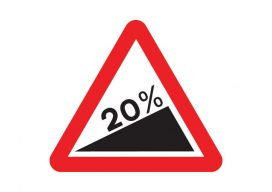
At the moment, I am doing a little work with the construction industry that requires road signs and markings placed on a map to show where signs need to move as the site(s) moves through different phases. Now, a real cartographer nerd would say that good graphics and symbolization would negate the need for placing...

Weekly xyHt News Links: 11/22/2019
MicroSurvey CAD 2020 released MAPPS Celebrates 20 Years of National GIS Day on Capitol Hill Assetino Cloud Based Cemetery Mapping & Management Tool Launched Study Values NGS Gravity Program at $4.2 to $13.3 Billion over Ten Years Topcon Solutions Stores announce partnership plan with Autodesk to expand Platinum-level service to all North American locations Pointfuse...

NSPS Forum for Women in Surveying
Above: An all-woman survey crew on the Minidoka Project in Idaho, 1918. The project was part of a large-scale irrigation system that controlled the flow of the Snake River with a series of dams and canals. While the recent Women Surveyor’s Summit is the first of what is hoped to be an ongoing new series...

Mentoring in the Age of Automation
Above: Darrell Hanners, LSI completes a topographic survey in the mountains of Caribou County, Idaho. As old-timers retire and fewer young people enter surveying, we are at a turning point where mentoring is crucial to the future of the profession, but we will need to adapt to mentor well. Land surveying is an ever-evolving profession....

R10 → R10-2 → R12: Explained
The announcement of a new flagship rover for Trimble was met with positive chatter, but with a lot of questions as well. So, xyHt called the product manager… In short, the familiar form factor of the R10 (slim bucket on a pole) is still there, but in the seven years since it was introduced it...
What Is PostGIS Day?
For the last 20 years, we have celebrated GIS day along with Esri. It is a great opportunity to get people who haven’t used GIS or mapping before in your office to have a look at what you do and maybe share a map cake (Note: It is traditional for GIS professionals to make a...
Advertisement