
Blog

Trends in Terrestrial Laser Scanning
Within the domain of lidar/remote sensing technologies, terrestrial laser scanning is currently the most widely adopted. Mapping drones have quickly become popular, but terrestrial laser scanning is used for more types of mapping and as-built survey applications. Other airborne (photogrammetry and lidar) and vehicle-mounted mobile scanning/mapping systems are also widely used, but there are far...
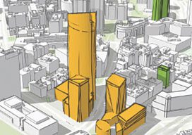
3D and Geospatial Infrastructure
When I look ahead to the future of geospatial infrastructure and 3D, the words that come to mind are: more, faster, and … more! Humans are poor prognosticators when confronted with exponentially increasing or improving factors, and today we see an explosion of capability and content in the geospatial world that will lead to new...

The FAA’s NPRM for Remote ID: Part One, the Basics
We’ve got a lot of material to cover on these important rules, so let’s jump right in. Remote identification (RID) is the FAA’s “license plate in the sky” for UAS that, once implemented, will pave the way for a host of advanced unmanned capabilities: beyond visual line of sight (BVLOS), operations over people (OOP), night-time...

GNSS: Triple-frequency Constellations
Triple-frequency observations for high-accuracy positioning has been studied for years. It’s proven to greatly improve RTK performance (fix rate, reliability, and precision) in challenging scenarios for dual-frequency RTK, for example with a very a long base line, very active ionospheric motion, and a severe multi-path environment. Triple-frequency observations also help shorten PPP convergency time significantly....

Weekly xyHt News Links: 1/17/2020
Introducing the Mesa 3 Rugges Tablet by Juniper Systems, Now Shipping Airborne LiDAR Market Size to Reach US$ 673 Million in 2025, Says Stratview Research DroneUp to provide Alaska with public drone services Carlson Begins 2020 with the Release of Scan2K Terrestrial Scanner Esri to Launch New Spatial Data Science MOOC HERE introduces HD...

The Reality of Digital Construction
In the last two decades, we have seen technology make its way first into the construction project office through construction management web applications, then into pre-construction through BIM and VDC (virtual design and construction), and finally into the field through mobile applications that are often intended to replace paper plans and specifications. With communications, business...
Advertisement