Blog

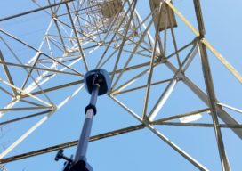
What is Tersus GNSS?
I had seen the name Tersus GNSS in geospatial social media for several years before our xyHt team stopped by their booth at the INTERGEO exhibition in Berlin in 2017. For a startup, launching in 2014, the company appeared to be making a lot of the right moves. As high precision GNSS was entering what...

xyHt Weekly News Links: 08/07/20
RIEGL’s Ultimate LiDAR Webinar Series and More: August 2020 SAM Announces Acquisition of Midland GIS Solutions Eyefly Uses Phase One iXM-100 to Achieve High-Resolution Image of Buggenum Railbridge Teledyne Optech extends its innovative airborne lidar sensor series with new corridor mapping model Versatile Geospatial Program Director Shelly Carroll Joins Woolpert GeoCue adds RIEGL Solutions to...

Citation (Jet) Needed: A Start-Up Takes Off
A wealthy investor on the other end of the line said, “Juan, I understand you are photogrammetrist and a pilot. Are you ready for a challenge? I bought six Citation jets in a government auction, and I want you to help me turn them into a modern aerial photography platform.” For those of us who...

xyHt Magazine Digital Edition: August 2020
xyHt is here again! If you don’t have a subscription to our print editions, or if someone else in the office has snaffled your copy, never fear—here’s the digital edition. Click here, or on the cover to the right, to view the August 2020 issue of xyHt magazine. Articles in the issue include: (Links will...

xyHt Weekly News Links: 07/31/20
Riegl Provides High Performance with 3D Laser Scanning Technology for HLR Carlson Announces Next-Generation BRx7 GNSS Receiver Fugro begins extensive site characterisation for ScottishPower Renewables’ East Anglia Hub Woolpert Selected by National Safe Skies Alliance to Develop UAS Response Guidebook for Airports Pearson VUE enters agreement with National Council of Examiners for Engineering and Surveying...

Why renting a UAV may make sense
I have a land surveyor client who’s interested in getting on the UAV train. But like many, he’s concerned with the financial outlay and not quite certain if the UAV path is the right one for his firm. His main concern: Will he be able to fully utilize and monetize the investment? That’s why I’m...

