All posts by Nicholas Duggan FRGS Cgeog (GIS)

Highlights of the Esri UC 2020 – Day Two
Highlights from Presentations and Exhibits at the Esri UC 2020: plenty of ArcGIS ArcGIS Workforce: Mobile app for worker, web app for dispatcher and project owner there is ArcGIS Platform Mobile app allows use of mobile app to complete to do list Web app allows the creation and management of work for mobile working GIS...

Highlights of the Esri UC 2020 – Day One
This is the 40th annual Esri UC (user conference), the first being held in Redlands California, the home of Esri’s HQ, with only 15 users. But it rapidly expanded in subsequent years, moving to the San Diego Convention Center where it has been held for many years. Now in 2020, the UC has gone virtual—with...

Let’s talk about MapOps
I’m not going to lie, I’m slowly mutating into one of those GIS high-level manager types who work less on real day to day map work and more about concepts and frameworks…even, at points strategizing. I hate it, give me some kriging interpolation or some hardcore viewshed analysis any day, but one thing is becoming...

What is ETL…
and How Can it Turn You into a Geospatial Rock Star? Imagine a world where there was only one data type for 3D, 2D and point clouds. Wouldn’t it be bliss? I have to confess that about 30 percent of my time, when I work in GIS, is spent working between different data formats…a DWG...

Build a Survey Tracker Map
We all have a little more time on our hands at the moment and it seems like the perfect time to do a little tidy of some of our data and do a little organization. In fact, I’m going to walk you through setting up something that clients have asked me to build for them...

Using Object Detection for More Accurate Live Mapping
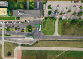
Almost a year ago today I was in a meeting where someone was telling me that the project we were working on needed to use LoRa positioning so that diggers and trucks could be tracked on a real-time map. I am not at liberty to give you my full response, but my professional response is...
