All posts by JoAnne Castagna, Ed.D.

Army Corps’ (JALBTCX) data improves coastal projects
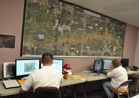
In a hotel conference room on Long Island, New York, a team of experts is processing data and information on computers. Alongside them is a large display monitor that is projecting the information. The team is the Joint Airborne Lidar Bathymetry Technical Center of Expertise (JALBTCX). “It’s a beautiful thing. On the screen they are...

CA Wildfire Cleanup
The U.S. Army Corps of Engineers, under the direction of FEMA and in partnership with the California Governor’s Office of Emergency Services, removed more than one million tons of fire-related debris. Credit: Carol Vernon, Public Affairs, Pittsburgh District, USACE. The U.S. Army Corps helps rebuild lives with GIS technology. In October of 2017, numerous, fast-moving...

Mexico City’s Transportation Revolution
Using drones, lidar, and BIM, enterprising surveyors and geospatial engineers designed and constructed the city’s first high-speed train system. Editor’s Note: Lessons learned from a problematic rail project in Mexico City prompted an initiative to pull out all technological stops for a subsequent new rail line. An innovative, tech-savvy firm that had demonstrated its capabilities...

High-res Hurricane Maps
It’s after sunset in Brooklyn, New York. As I open my apartment window, suddenly I sense a strong, ocean aroma. I look outside and am shocked to see a deep surge of seawater flowing up the street quickly from a nearby boat marina. The street lights flicker, and in the water flows large tree limbs,...

USACE GIS Cadre Mapping Team’s Future
The cadre is a team of Army Corps employees from throughout the nation who are GIS subject-matter experts. When a federally declared disaster occurs the team gets ready to deploy and can be on the ground in just hours, setting up their own equipment even before other agencies are on the scene.
