All posts by Jeff Salmon

Located: April 2025
Compiled by Jeff Salmon Europe Kickstarts its Own Sat-Com The European Union will soon boast its own secure communication satellites system similar to Starlink with the signing of a new space contract in Brussels, Belgium, in December. IRIS², short for Infrastructure for Resilience, Interconnectivity and Security by Satellites, will be composed a multi-orbital constellation of 290...

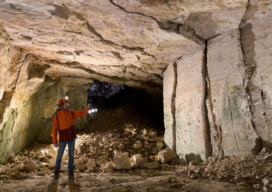
Creating Digital Twins for Water Resource Management in Caves
A substantial part of Switzerland’s water resources exist in its complex karst aquifers, a critical natural system that continues to pique the interest of researchers. At the Neuchâtel Centre for Hydrogeology and Geothermics (CHYN), a team of scientists led by Professor Phillipe Renard and accompanied by climate scientist Dr. Tanguy Racine launched an initiative seeking...

A Digital Twin of Bandelier National Monument
Two graduate students, Gracie Meek and Jialei Tang from the Harvard Graduate School of Design, are capturing the past with new geospatial digital tools. Their recent project at the Bandelier National Monument is a remarkable intersection of cultural heritage and cutting-edge technology.

Geospatial Markets 2023
With a declining housing market and a possible recession, where are the opportunities in 2023? If you follow the news at all it’s been hard to escape the media drumbeat of “recession next year.” How deep will it be and how long it will last seem to be the only topics up for discussion. Predictions...

Autonomy Comes to UAVs
Trending tech has UAV software looking futuristic To a certain degree, autonomous operations are already baked into the current state of data collection (aka reality capture) software for UAVs. Pre-mission planning consists of using a map-based interface to highlight the area that needs to be mapped or inspected, the appropriate flight pattern and height (AGL)...

How Not to Crash (or Lose) Your Drone
Lessons from flying, crashing, and occasionally losing, drones
