All posts by Guest Writer

From Meters to Centimeters
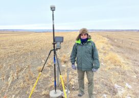
Understanding correction services for GNSS By Towfique Ahmed Real-time correction services were created to enhance the accuracy of Global Navigation Satellite Systems (GNSS), reducing errors from tens of meters to precise, centimeter-level measurements. While some applications can function with sub-meter accuracy—such as those supported by regional Satellite-Based Augmentation System (SBAS) solutions—surveying requires far greater precision....
Advancing Geospatial Excellence
Advancing Geospatial Excellence: A model for public-private collaboration
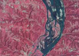
How a federal liaison program and geospatial data help American agriculture
How a federal liaison program and geospatial data help American agriculture

Sponsored Content: How geospatial firms are maximizing ROI on smarter business processes
Transform Your Geospatial Workflow with X-PAD Office Fusion software
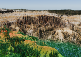
Utility Management Vegetation
Managing vegetation around America’s electric transmission and distribution infrastructure is crucial for ensuring uninterrupted power delivery. Utility Vegetation Management (UVM) is highly complex and represents a significant cost burden on utility operations and maintenance (O&M) budgets. This includes essential tasks such as tree trimming near power lines, which are critical for service reliability, grid resiliency,...
Sponsored Content: Maximizing surveying efficiency with Trimble CenterPoint RTX technology
Maximizing surveying efficiency with Trimble CenterPoint RTX technology