The general aviation (GA) industry in the United States is enormous, and that has contributed to the rapid development of traditional aerial photogrammetry in our country over the last six or seven decades. Aircraft acquisition, maintenance and adaptation of cameras and sensors are relatively easy and certifications of such modifications with the federal aviation administration (FAA) are straightforward.
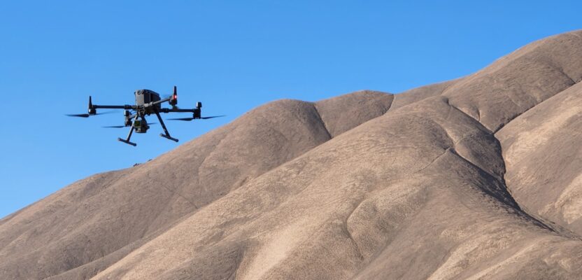
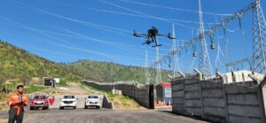
A UAV flies a mission of a photogrammetric project involving an electric transmission line project in Region de Atacama Chile.
The same is not necessarily the case in every country around the world as GA aircraft are rare and aviation mechanics and spare parts are not easy to find. That is why in most developing countries, aerial photogrammetry needs were fulfilled by international contractors, the mandatory military mapping agency, or, though rarely, a local company with a small single-engine plane and a simple camera.
With the advent of drones, small cartographic cameras, and incredibly powerful and inexpensive photogrammetry software, more and more traditional land surveyors are adopting and adding aerial capabilities to their practices.
Chile in particular is a very interesting case because of the complexity of its geography and the enormous distances that professionals have to encompass in order to attend a national clientele.
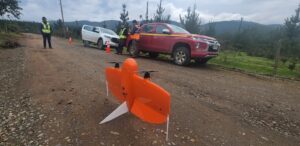
Introduction of fixed wing platform in support of road infrastructure in southern Chile.
We found a company in Santiago de Chile, Ingenieria Geomatica Tres, or IG3, that has been mapping with drones since 2011 when the company adopted a crude, early platform and some basic photogrammetry software to complement their field work. We spoke with IG3’s founder and CEO Alfredo Solorza for a fascinating conversation on how our industry has evolved from exclusive and expensive to available and affordable.
“I was lucky to be a geodesy professional and serving in the Chilean navy at the same time. That allowed me to join the area of the force that was in charge of mapping the coast,” Solorza said. “We had our own aircraft and an entire battery of stereoplotters and for years I learned the tricks of the trade. For example, how to strategically place ground control points (GPT) to satisfy the strength of our photogrammetry model, the requirements of photography overlap, both longitudinal and transversal. It was a crash course in the entire workflow of a photogrammetry mission, from planning the flight to plotting the final map.”
In 2005 the Chilean navy began using satellite photographs to add cartography to some of the more isolated and remote areas of the country. Areas that were difficult to access with traditional aircraft due to altitude or distance.
“I used satellite imagery to create some great maps of regions that had never been mapped before.” Solorza said. “But in 2008 the time came for me to retire, and I created my own land surveying practice in partnership with a Canadian company that had an earlier lidar sensor mounted in a helicopter. With this technology we began creating amazing 3D imagery of areas that were earmarked for development of roads and electric transmission lines.”
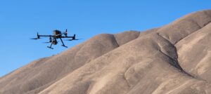
More than 13,000 feet above sea level, a renewable energy project in Atacama desert Chile.
The transition from government work to private practice gave Solorza a new perspective on the importance of costs and profit, and therefore he embarked on a crusade to find ways to replace the helicopter and still be able to provide his customers with the same quality aerial product.
“In 2011 we bought our first DJI drone and a copy of an early version of PIX4D, and with that we began our incursion in the world of aerial photogrammetry with a remotely piloted aircraft (RPA),” Solorza said. “The first few jobs were just to use the drone to complement the ground crews by creating a digital terrain model (DTM) that would allow the office personnel to digitally remove buildings and structures that cluttered the final cartographic product.”
It would be useful to remember that PIX4D launched its first version in 2011 and that drones that year had limited capabilities to perform complex photogrammetry mission, and therefore Solorza and his team at IG3 were world pioneers in the emerging science of uncrewed mapping.
“In 2022 we upgraded our DJI platform with a lidar and at that point the accuracy and quality of the end product was so spectacular that we moved 90 percent of our mapping operations to be aerial, with the ground crews only playing a support role,” Solorza said. “We fly the area with two sensors, one conventional imagery and then with the lidar and this way we have an orthophotomosaic that contains precise elevation and a healthy number of control points to prove our accuracy.”
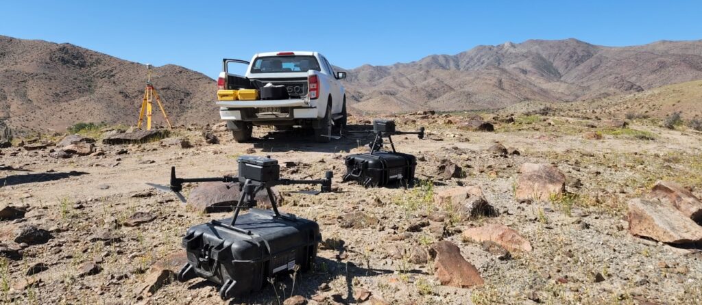
A photogrammetric project using idar for an expansion project of an electrical substation in Santiago, Chile.
There are a number of ways to use drones in photogrammetry, and Solorza and his team have decided that the best and most efficient way to use their uncrewed aircraft would be using PPK (post processing kinematic) for some more precise missions and RTK (real time kinematic) for less rigorous jobs.
“Today we can deploy our drones to any part of the country in a matter of days and execute the most complex jobs in record time,” Solorza said proudly. “We have specialized in two basic products, one is the 1:1,000 with contour lines every meter (3.28 feet) and second, the 1:500 with contour lines every 50 centimeters (1.64 feet). These two digital maps are essential for the design of roads and electric transmission lines that our customers require. With this basic cartography, we can create 3D models of any surface, allowing the design engineers to create their networks over a realistic 3D version of the terrain as opposed to a flat surface that requires a lot of conversion work to be effective. Now we are planning to upgrade to the latest generation of lidar technology and keep up with the pace of technology.”
It is clear that traditional photogrammetry will continue to exist for large areas and high-altitude jobs, such as mountains and high plateaus, but companies around the world are adopting these incredible and affordable aerial uncrewed platforms which have the capability to convert any land surveying firm into a solid aerial photogrammetry concern.